Stanage Edge
| OS Map : | 110 |
| Start : | Car Park at Burbage Bridge. |
| SK260830 | |
| 402 | |
| The car park at Burbage Bridge is a very busy, especially in the good weather. It is used by walkers and climbers alike. Otherwise there is parking further along the road north towards Stanage itself. If this is the case then a shortened route may make sense. | |
| Summary : | Burgbage Bridge - trig point - High Neb - Stanage End - Roman Road - Burbage Bridge |
| distance : | 14.0km. |
| ascent : | 230m. |
| time : | 4hr. 30min. |
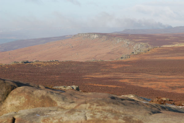
View of Stanage Edge from Southern trig .457
©gritstoneedge.co.uk
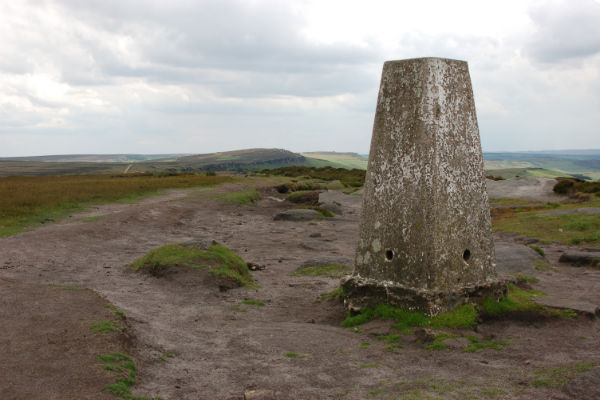
High Neb trig point looking north.
©gritstoneedge.co.uk
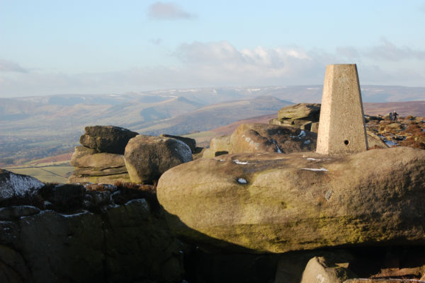
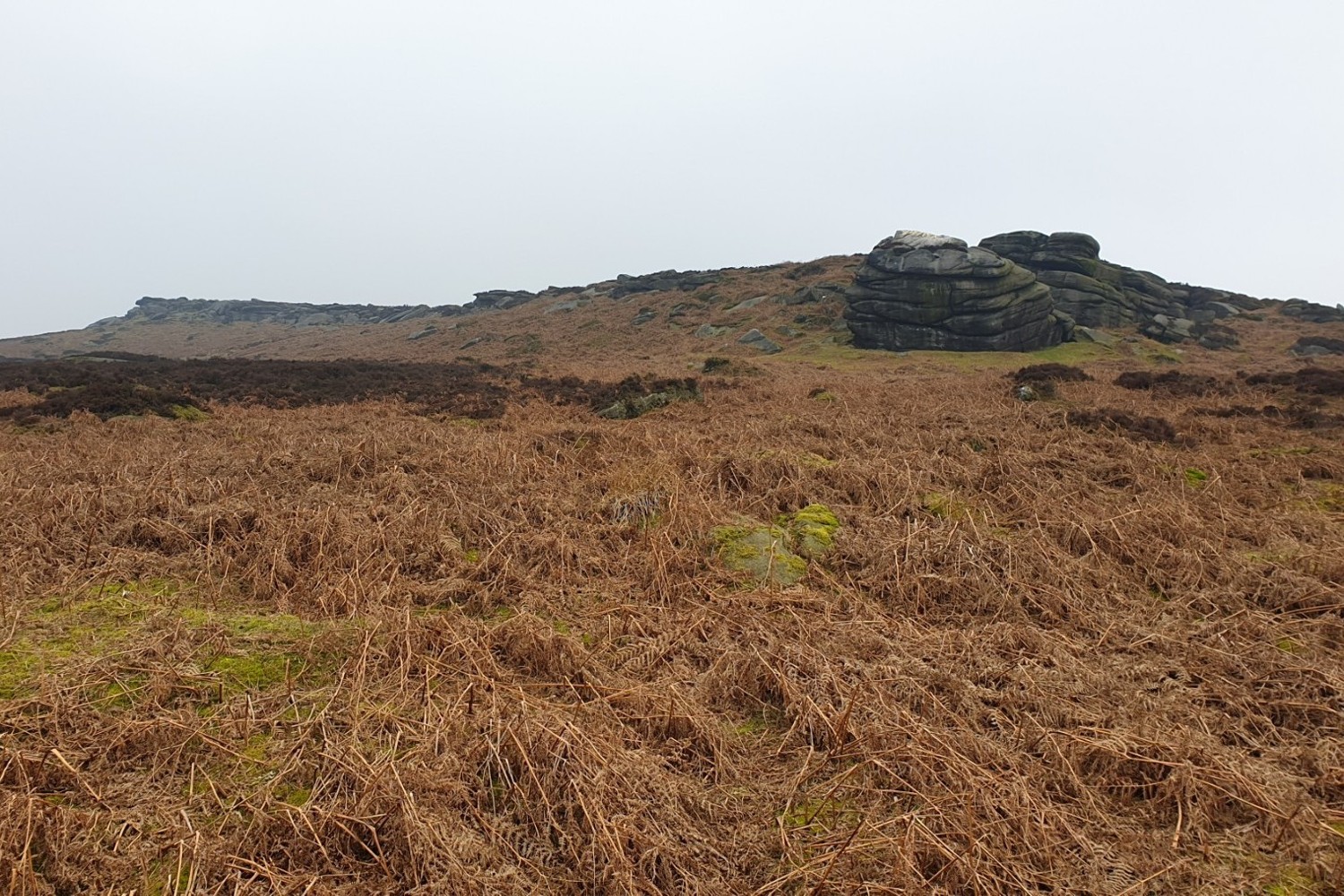
.457 set amongst the rocks and a good view of the Hope Valley
©gritstoneedge.co.uk
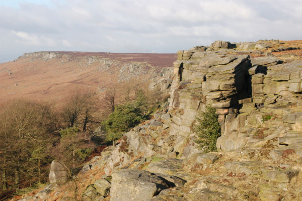
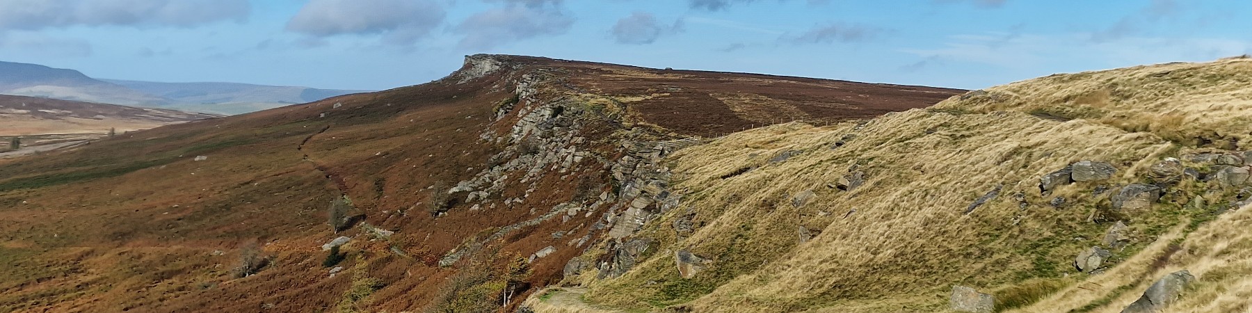
The full sweep of Stanage Edge
©gritstoneedge.co.uk

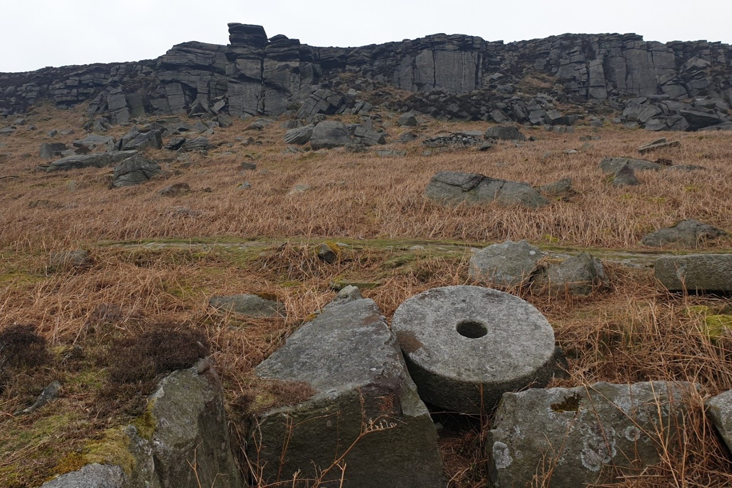
Millstones are a feature of this edge showing part of the heritage of this area of the Peak.
©gritstoneedge.co.uk
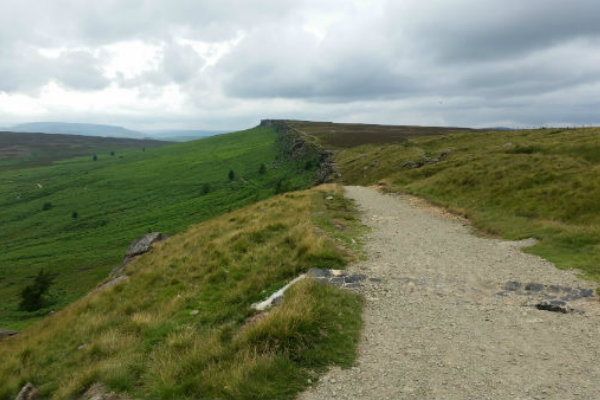
Looking north towards along the sweeping edge from the Long Causeway.
©gritstoneedge.co.uk

The southern view from the top of the edge around the Long Causeway.
©gritstoneedge.co.uk
The view of Crow Chen from the path.
©gritstoneedge.co.uk
The far south end of Stanage from Burbage bridge.
©gritstoneedge.co.uk
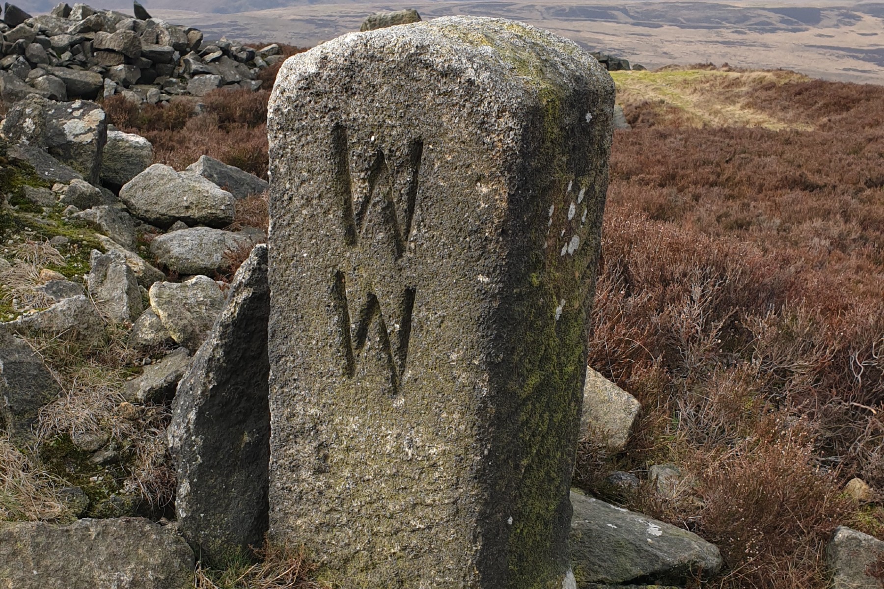
The WW marker stone at Stanage End.
©gritstoneedge.co.uk
edale
Current Weather
Last Updated today at : 04:14:25
| Overall : | broken clouds |
| Temperature : | 15degC. |
| Wind Speed : | 10km/hr. |
| Wind Direction : | SSW |
| Clouds : | broken clouds |
| Precipitation : | none |
| Sunrise : | 03:40:52 |
| Sunset : | 20:39:30 |
| : | Times are GMT add 1 hour for BST |
Data from openweathermap.org
The gritstone edges running along the east of the Dark Peak are unique to the Peak District. Stanage is the grandest of all these gritstone edges running some 6km sin length. Best viewed from a distance. This route takes you along the full length, walking above and below the crags. Stanage Edge is a popular rock climbing area and busy with climbers in all weathers. The edge can be accessed from a variety of places. This route starts at the southern edge and follows above the edge for it's full length. The return journey is undertaken below the cliffs providing some extra interest viewing the rock climbers in action.
Start at Burbage Bridge. There is a lot of parking here but it is popular with rock climbers as well as all sorts of walkers. There are various places up and down the road where parking is allowed.
From the car park follow the road for some 50m to the corner and then take the path up towards Stanage Edge, the southern extreme of the line of cliffs. It is easy to reach the top of the crags here. Follow the top of the line of cliffs to reach the trig point. This is set on top of some significant gritstone boulders. On a good day there are excellent views north along the edge as well as over the Hope Valley. (1.0kms. 40m. 0hrs. 30min.)
Look north at the trig point and see the great wide vista that is Stanage Edge, this is where the route takes us, along the top of this magnificent edge. Leaving the trig point follow the path north along the top of the edge. Keep an eye out for the magnificent views west along the Hope Valley, east over Broomhead Moor and indeed north along the edge. At about 2km. the Long Causeway coming from Redmires Reservoirs is visible. The large pole, Stanage Pole is clearly visible from the edge. Climb the fence and follow the path to the causeway and then over a surprisingly narrow piece of path to reach the top of the second half of Stanage Edge. Follow the path on top of the cliffs along to the trig at High Neb. (3.5kms. 50m. 1hrs. 10min.)
The route now continues along the path on top of the edge. The edge is less popular in this area, there are fewer walkers and climbers on this northern section of the edge. Even on a busy day this north end of Stanage is still a quiet and tranquil place. Follow the top of the edge until the rock become less distinct over Stanage End. Eventually a wall is reached where the top path meets the lower path. Here are the remnants of an old quarry. Look out for two distinct marker stones with WW and WM carved on them. These indicate the boundary between shooting estates. This is the time to turn around and maybe take a bite to eat looking west over the northern moors of the Peak District. (2.5kms. 20m. 0hrs. 50min.)
If the wind was in your face it is now at your back; the sun is likely to be straight ahead to giving a different aspect to the edge. Follow the narrow and sometimes confusing path along the bottom of the edge. There are many paths, and there are a few wet areas to negotiate. It matters not which you take. This can be followed in it's various guises until the long Causeway is again reached. (3.5kms. 20m. 1hrs. 10min.)
From here the return is by the outward route. Follow the Long Causeway to the top of the edge. Here the walk can be lengthened by continuing to Stanage Pole and back. This detour is worth while on a nice day with the views over much of South Yorkshire. It is an interesting game to pick out the buildings of Sheffield, Doncaster and beyond. Once back at the edge, climb the wall by the stile and follow the path along the top to reach the trig point. Continue along the path, as it turns east at the southern end of the edge. At the significant path, descend and return to the car park at Burbage Bridge. The start, and finish of this walk may be changed dependent on where the walker finds to park the car; Burbage Bridge is busy. (3.5kms. 100m. 1hrs. 20min.)
22nd June 2021 A bright summer day, with a bit of wind. Walked along Stanage from Redmires reservoir rather than the south at Burbage. One north of the Roman Road it was very quiet, in fact, on my own at the far north. Nice to sit a while and take in the views of Kinder and around to the eastern edges of Bleaklow.
1st January 2020 The tradition is to walk along Stanage on New Year's day, as indeed it appears to be for many others. This time the two trig walk from Redmires. Difficult parking as this area is popular on NYD. Once at the edge it was south to main top. very wet underfoot, then back to the second trig point. Back along the bottom of the crag to get a good view. Even today in the cold damp and wind there were people climbing.
20th November 2019 Stanage is a great place for a short walk on the days, like these, where it is not great weather for the outdoors but you want the experience of being on the moors. Rather than a Burbage Bridge start, it was a Redmires Reservoir start ad walk up to Stanage Pole then to edge. Turn left, south, to climb the popular area, as today, or right to follow the less popular area, or indeed both. A great place to be out on a not so nice day.
28th February 2019 Not a busy Thursday, so easy to park at Burbage Bridge. Actually a bit of a misty day after a long period of spring like weather in February. The route was not busy and indeed the northern section was deserted. Pity the views were not great. I noted that whilst the southern popular end was quite muddy the paths in the northern sections are much better and there is less jumping to avoid the wet area. It was great to sit a while and just meditate, looking over the moorland.
1st January 2019 Did part of the route, between the two trig pints on a sunny New Years Day. Seemed that everyone was out. Not surprising as it was a great winter day with good views up and down the edge. And the sun was out. Muddy underfoot which is as expected in this popular part of the Peak District.
 My Blog
© gritstoneedge.co.uk all rights reserved 2015-2026