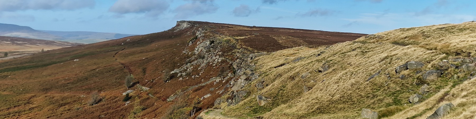
Outer Edge from Derwent
| OS Map : | 110 |
| Start : | Kings Tree |
| SK169950 | |
| 270 | |
| There is limited car parking at the end of the road on the side of Howden reservoir. The road from Fairholms, at the end of Ladybower Reservoir, is closed on Saturdays, Sundays and Public Holidays. So this is a walk for midweek. | |
| Summary : | Kings Tree - Slippery Stones - Cut Gate - Margery Hill - Outer Edge - Rocking Stones - Crow Stones Edge - Slippery Stones - Kings Tree |
| distance : | 9.0km. |
| ascent : | 320m. |
| time : | 3hr. 20min. |
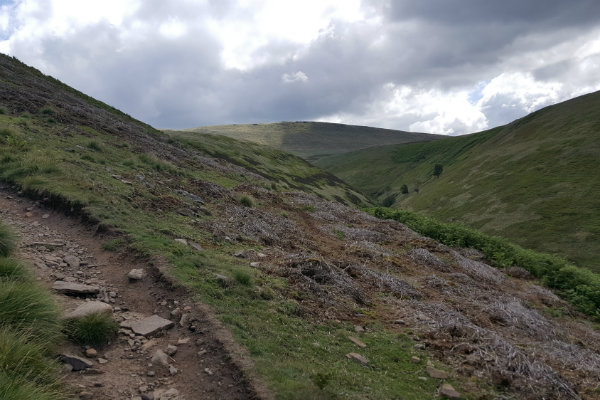
The route up Cut Gate from Slippery Stones to the skyline
©gritstoneedge.co.uk

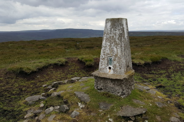
The summit of Margery Hill
©gritstoneedge.co.uk
The summit of Outer Edge
©gritstoneedge.co.uk
View of Crow Stones Edge down to Howden Reservoir.
©gritstoneedge.co.uk
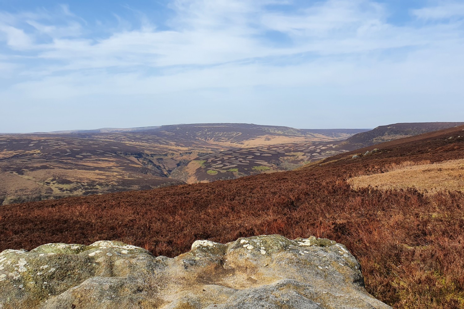
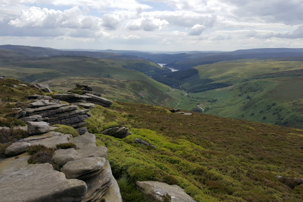
View from Outer Edge over to Bleaklow Stones.
©gritstoneedge.co.uk
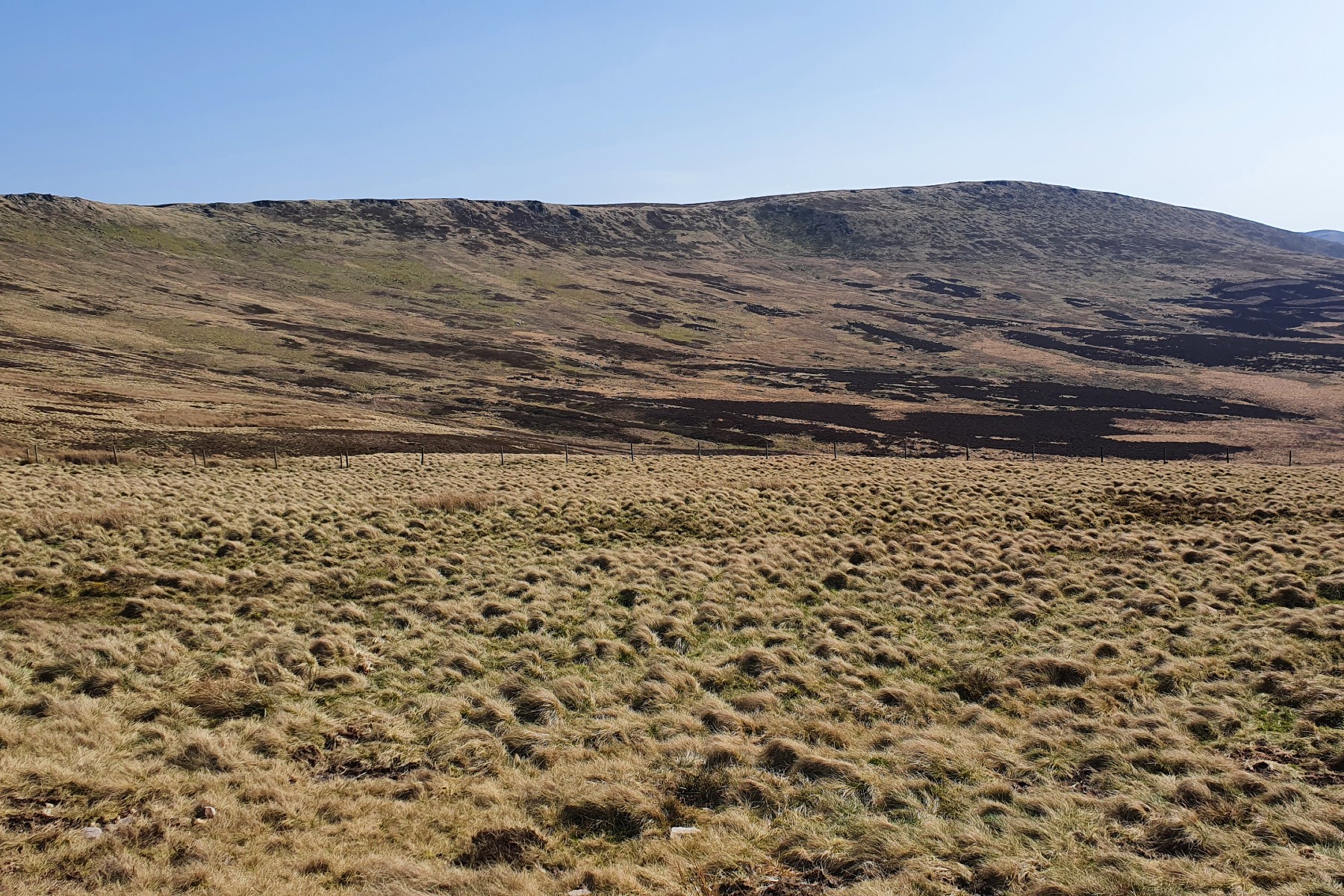
View on way up of High Stones.
©gritstoneedge.co.uk
Edale
Current Weather
Last Updated today at : 04:04:12
| Overall : | broken clouds |
| Temperature : | 15degC. |
| Wind Speed : | 10km/hr. |
| Wind Direction : | SSW |
| Clouds : | broken clouds |
| Precipitation : | none |
| Sunrise : | 03:40:52 |
| Sunset : | 20:39:30 |
| : | Times are GMT add 1 hour for BST |
Data from openweathermap.org
The northern part of the Eastern Edges from Lost Lad (SK193912) north to Margery Hill and Outer Edge is wet and boggy and predominantly pathless. The area is not busy and the walker gets a sense of remoteness albeit only a few kilometres from Sheffield. It is a pity to miss out on this area, so this route uses Cut Gate to access the ridge. This remote area gives some excellent walking and often it is much quieter than the other areas in the Peak District. The views down the reservoirs are good so pick a day with good visibility.