Mam Tor - The Great Ridge.
Mam Tor from Castleton Valley.
©gritstoneedge.co.uk
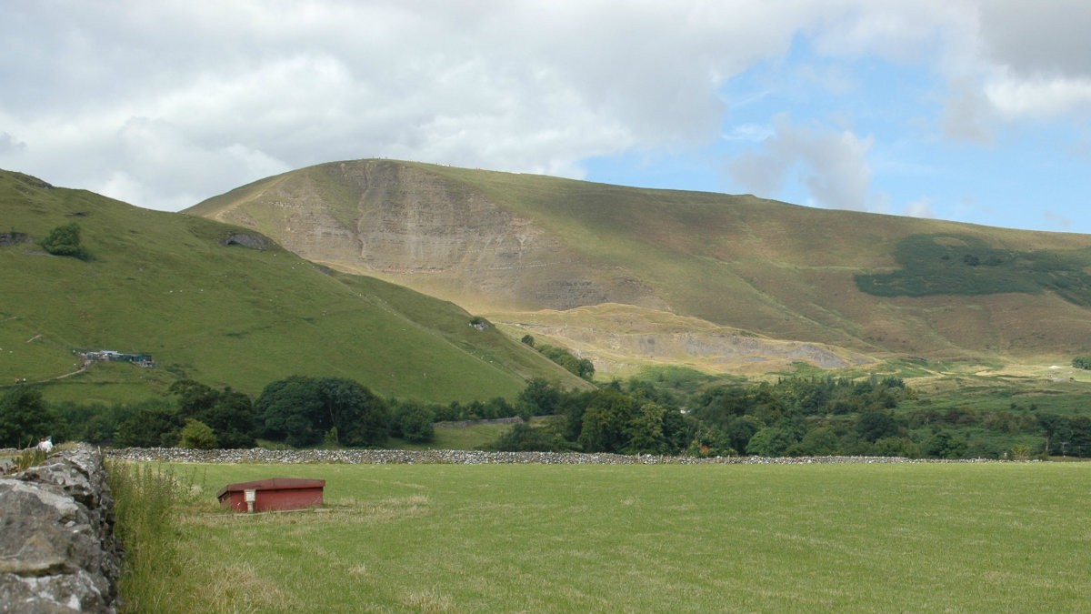
MamTor from Castleton Valley road.
©gritstoneedge.co.uk
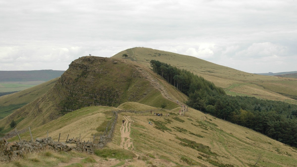
Looking back to Back Tor and Lose Hill.
©gritstoneedge.co.uk
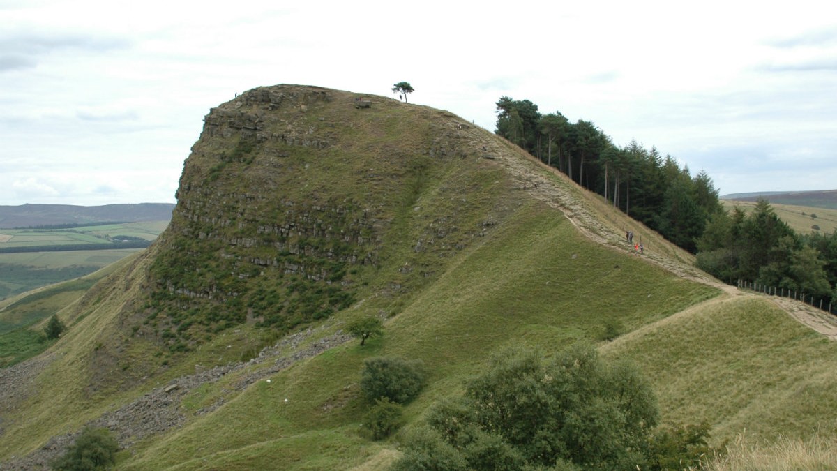
Back Tor.
©gritstoneedge.co.uk

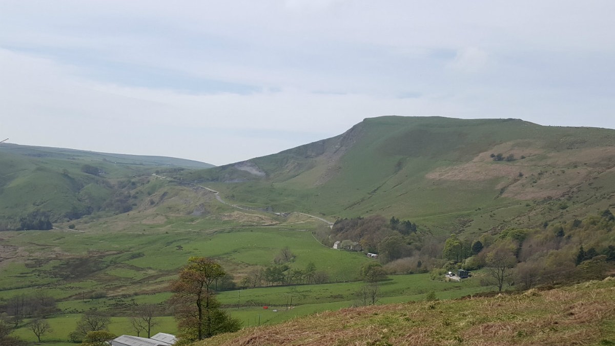
Towards Mam Tor.
©gritstoneedge.co.uk
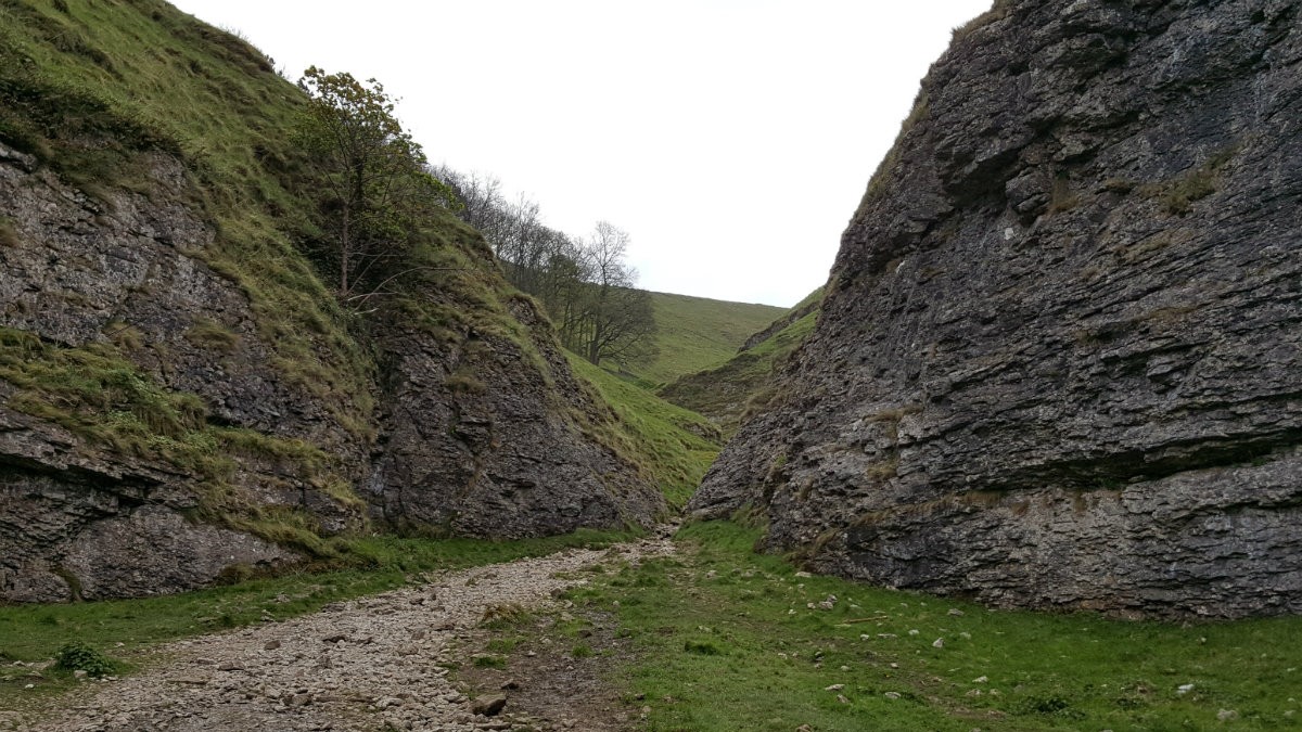
Looking up Cave Dale.
©gritstoneedge.co.uk
Misty morning in the valley.
©gritstoneedge.co.uk

Cloud inversion around Mam Tor
©gritstoneedge.co.uk

Back Tor
©gritstoneedge.co.uk

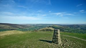
Mam Tor Trig - with a view
©gritstoneedge.co.uk

Mam Tor Trig - no people
©gritstoneedge.co.uk

Mam Tor - the face
©gritstoneedge.co.uk

Broken Road.
©gritstoneedge.co.uk
| Hill Summit : | Mam Tor[SK127836, 517m.] |
| Hill Summit : | Lose Hill[SK153853, 476m.] |
| Start : | Castleton Car Park The main car park in Castleton.[SK149830 200m ] |
| Summary : | Mam Tor - Losehill Farm - Lose Hill - Back Tor - Mam Tor - Cavedale - Castleton |
| distance : | 11.5km. |
| ascent : | 400m. |
| time : | 4hr. 10min. |
"The Great Ridge" is a name given to the Lose Hill, Back Tor, Mam Tor ridge that dominates the westerly part of the Hope Valley. This route climbs the ridge at the eastern edge and follows around the Castleton skyline going initially to Mam Tor and then down into Limestone country, through the fields, and finally down Cave Dale back to Castleton itself.
Edale
Current Weather
Last Updated today at : 04:29:54
| Overall : | scattered clouds |
| Temperature : | 4degC. |
| Wind Speed : | 5km/hr. |
| Wind Direction : | ENE |
| Clouds : | scattered clouds |
| Precipitation : | none |
| Sunrise : | 04:17:29 |
| Sunset : | 19:49:57 |
| : | Times are GMT add 1 hour for BST |
Data from openweathermap.org
Start at Castleton. There is a path alongside the stream that runs beside the car park. Walk to the stream and turn left to follow the path alongside the stream, through a small street until it meets a road. Turn left to leave Castleton on Hollowfield Road. Follow this road until the track on the right at the Training Centre. Follow the track to the Environmental Centre. Just past it is a sign pointing to a footpath, follow this through the various turns and gates to just below Losehill Farm. Here take the signposted path left that climbs the hill, another gate or two and you are at the summit of Lose Hill or Ward's Piece. (3kms. 300m. 1hrs. 30min.)
Walk along the length of the Great Ridge. From Lose Hill the full extent of the ridge is in view with a good wide path. Descend from Lose Hill and then reascend Back Tor. Down again from Back Tor to Hollins Cross. Make sure you turn around to see Back Tor as the most impressive side is from the west. Hollins Cross is the pass between Castleton and Edale and very busy. It is marked with a direction dial. From here the path ascends Mam Tor and again it is good wide and busy. Indeed Mam Tor summit with it's trig pont is one of the most busy places in the Peak District. (3.5kms. 100m. 1hrs. 20min.)
The route now goes into White Peak area. Descend Mam Tor by the obvious path and at the road, turn left and through the gate. Descend through the field to meet the Winnats Path road. Cross this road and through the gate to the track going to Rowter Farm. Follow this well made track until SK135813. At this crossroads turn left, east, and follow the path towards Cave Dale, part of the Limestone Way. The path follows fields and then descends into Cave Dale itself. It is very tight in a number of places. The sides of the dale have some interesting features, holes, in the limestone rock. At the bottom is a gate that leads to Castleton. Follow through the streets to reach the car park. The lower slopes of Cave Dale are often wet, and slippy, even after a long dry spell. (5kms. 0m. 1hrs. 30min.)
4th December 2024 A cold and misty day bput well worth the walk up to the summit of Lose hill and along the Great Ridge. Rather than follow this route onto Cave Dale, I descended the broken road back to Castleton. I didn't fancy the descent of Cave Dale when it was likely to be very wet and slippy.
11th December 2023 A wet day that did not clear up as forecast. Set off from Castleton and up Cave Dale, usually I have walked this route the other way. Once on the top walked along the path to the road. By which time the rain was too much, so descended the road rather than attempting Mam Tor. It would not have been worth it.
14th September 2023 A day with a poor forecast of rain but decided to go out anyway. Yes there was cloud around but it cleared over the day. The views were not clear but were atmospheric. A good example of going out despite the weather forecast as there are some great experience to be obtained even on a not perfect day.
3rd January 2020 Mam Tor is one of the most popular hills in the Peak District and today was no different despite the cold damp and wind later on. Very slippy underfoot; do they make special mud here? Decided against Cavedale as this is slippy at the best of times and it would be treacherous today. Walked down the old road. Surprising how much it has slipped since the closure in 1979.
Use this link to view all the external gritstoneedge.co.uk resources.
 gritstoneedge linktr.ee
w : https://www.gritstoneedge.co.uk
e :
 gritstoneedge Blog
 gritstoneedge instagram
 gritstoneedge YouTube channel
 gritstoneedge Podcast
Disclaimer :This site has links to many adventures in the outdoors, walking or cycling in hills and moors, within the UK. These can be dangerous activities. Conditions can change rapidly in the outdoors. The information and links provided on this site is given in good faith. gritstoneedge.co.uk cannot be held responsible for any loss or injury caused by encouraging you into the outdoors of by the accuracy of the information provided on this site.
© gritstoneedge.co.uk all rights reserved 2015-2025